
Greetings DroneHive Family,
When I last wrote, we were hunkered down for the holidays preparing for what we expected to be the start of a crazy year of growth and development for the UAS solutions marketplace. I wasn’t entirely correct or prepared for how much demand we would see in these three short months! I’m sure you see and feel this in your local and regional UAS ecosystems. I can now confidently say that 2022 may be the first time we see RPIC demand outstrips supply (at least for the pilots we want to work with and represent DroneHive!).
You’ve heard it in the news and read it in the headlines: Everyone is #hiring, but no one can see to hire. You may be aware that I am lucky enough to reside in the beautiful resort town of Park City, Utah. We are on the front lines of this issue. Vail resorts provided a sub-par mountain experience here at the resort across the street, which occurred across their portfolio. Their justification for dirty bathrooms, closed lifts, and long lines were a lack of staff. The solution to Park City residents was clear and straightforward: offer more pay! Unfortunately, many Vail employees were paid less than those working at fast-food restaurants in town. Vail announced last week that it is raising minimum pay from $15 to $20 per hour. They listened, but I’m still not convinced it will be enough for next winter’s ski season. More broadly, there seems to be a disconnect across all labor forces and the pay offered for their services. While we have been lucky and appreciative of our clientele to recognize, understand and act, we still are in discussion with many that we see further need to come together with offerings to make the remote piloting opportunities more attractive. They are listening! They want the most talented RPICs for their projects and know they need to compete.
Management Accounting Fact: Labor is a variable cost, not a fixed cost that needs consideration for our partners’ and clients’ needs. The increased fuel cost will continue to add to the variability of labor costs as all of our pilots drive to their UAS inspection jobs. (Maybe finally time to go electric?) We are also seeing that full-time, salaried, W-2 with benefit Remote Pilot positions are becoming more available and more attractive. We are helping more companies with remote pilot sourcing than ever before. Many of these opportunities are in remote areas for testing, and other ongoing UAS operations demanded in these sparsely populated environments. If you can relocate and are interested in a salaried RPIC career path, please let us know ASAP! (Most of these opportunities do not currently offer relocation assistance, but we’re working on it with the hiring managers.)
The world throws wrenches at us, but we continue to dodge and rebound. What’s next? Who knows if this is a blip in the overall marketplace, our marketplace, the global labor forces, or if it’s here for good. I’ll be watching, listening, and learning throughout Q2 and hope to have some answers for you in our following Buzz newsletter! Stay tuned.
Cheers from your Founder,
Paul Huish
Chief Executive Officer
“The secret of change is to focus all of your energy not on fighting the old but building the new.” – Socrates
Socrates is perhaps one of the greatest philosophers of all time. His beliefs are foundational in Western Philosophy and the quote above is one I fall back on regularly.
At DroneHive, we know that the drone climate in North America is changing and quickly. We believe we must innovate and build tools in advance to support the massive growth and expansion of drones in business operations across a vast array of industries.
That said, we are thrilled to announce the launch of our new website. For the first time, DroneHive clients can now submit project requests online. We support both simple projects requests and with more advanced details, including the ability to upload your KML/KMZ files. We have also improved our online application for Drone Pilot candidates. Throughout the website, we believe you’ll find a better user experience and valuable information such as actual DroneHive industry specific case studies. See for yourself: www.dronehiveinc.com.
Each month, we’ll Spotlight a DroneHive Partner or Pilot. For the remainder of March and throughout April, please learn more about our Spotlight Partner: Pointerra. Our clients use Pointerra for the ease-of-use in managing their 3D datasets.
For years, our clients have come to depend on us to provide top-notch Drone Pilots for their projects. Today our clients also rely on DroneHive for end-to-end project management and consulting services (training, hardware recommendations, etc.). Our team has expanded over the last year to support this need and we’re excited to introduce you to the people behind DroneHive on our social media accounts in the coming weeks.
Wishing you a happy and healthy Spring,
Meagan
Meagan R. Zeman
Chief Operating Officer
Alongside Pointerra, we’re moving toward a better tomorrow. Pointerra is the world’s fastest, true end-to-end 3D data solution.
100% deployed in a secure and scalable cloud environment, Pointerra’s patented technology and AI-driven algorithms bring ease-of-use for managing any size 3D datasets with team-members and clients.
Pointerra’s browser-based tools allow stakeholders to drastically increase efficiency in managing data and the ability to share results with end-users. For practically any type of GIS or remote sensing format, Pointerra provides the ability to take complex data and turn into insights, providing answers using digital twins to remotely manage the environment.
If increasing your team’s efficiency managing complex workflows or allowing your customers to further engage with data products is of interest, please reach out to Pointerra at https://www.pointerra.com/contact/ or sign-up for a free trial to experience Pointerra3D https://app.pointerra.io/tryit/.
Suggested Best Practice: Thermal Mapping and Inspections
Greetings fellow RPICs,
Over the past year, DroneHive has seen an uptick in client job requests for thermal imaging. We like to pass our experience and client interactions to our current and future pilots interested in performing thermal captures to deliver quality datasets to our clients.
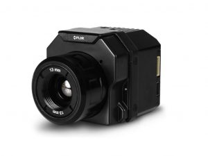
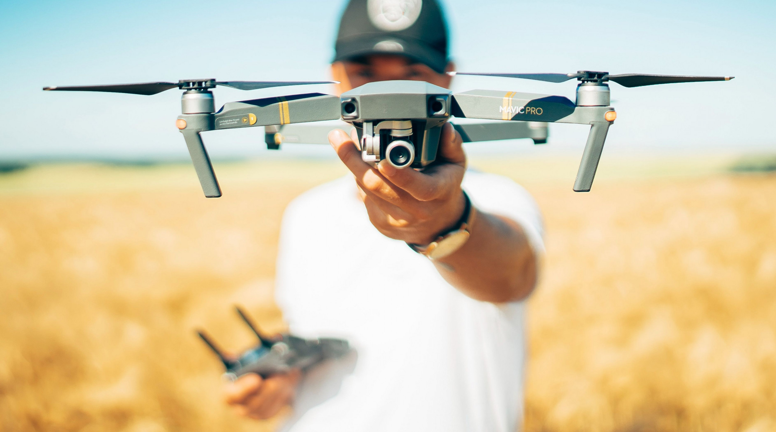
The most requested inquiry by our current pilots who are exploring a procurement of a thermal sensor is what sensor should I get? Based on our client requests, the most requested sensor configuration is a high resolution, 640×512 pixel dimension, a RADIOMETRIC sensor such as the FLIR Vue Pro R. The frame rate between 9-30 Hz would be relevant for video only, and lens (FoV) can be narrow, wide or in-between, such a 13mm lens giving you a 45-degree FoV.
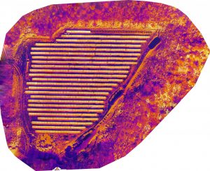
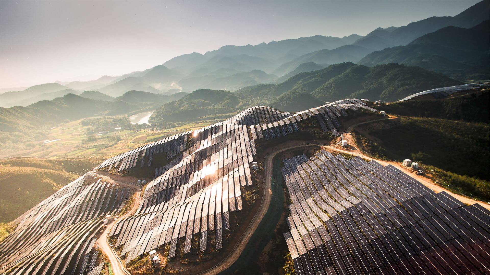
There are two types of thermal inspections, solar farm panel inspections, and building/roof inspections. The two operate under different environmental conditions. Solar panel inspections are best flown with maximum irradiance on the panels from the sun. Maximum irradiance will be achieved when the sun radiance is incidental to the panel surface with minimal or no cloud cover. Therefore, the ideal capture time window will be centered around local solar noon, with little or no clouds. To ensure sufficient irradiance, we recommend having an irradiance meter on-site. This will be critical if you have some overcast contributing to the degradation of the sun’s radiance. You don’t want to re-fly because you were unsure of sufficient irradiance!
The other thermal capture type is natural surface body radiation, measuring a local surface temperature to detect structural anomalies, such as roofs. Unlike the solar panel inspections, you do not want any contributing solar energy absorbed by the sun to taint your temperature measurements; therefore, the best time to conduct this type of inspection is when all or most of the absorbed solar energy (heat) has dissipated, well after sunset. The best time would then be an hour or so before sunrise. However, pilots often prefer to conduct as early as one hour past sunset to have enough sunlight to arrive on-site and set up.
As part of your thermal inspection checklist, we recommend, if the feature is available, to calibrate your thermal sensor before arriving on-site and/or include imaging the calibration target on-site to ensure that there is no drift in the absolute temperature measurements. Also, we advise pilots to address any non-automated LAANC authorization and/or DJI unlock license issues before arriving on site.
Another pro tip is to check the coverage of a mapping flight before departing the site. Even with Pix4DCapture or DroneDeploy, there will be occasions when an image or two are missed along the flight track and will break the ability to stitch an orthophoto completely. You can use the free QGIS software to import the images onto a map to confirm coverage; it is available on all three platforms: Windows, OSX, and Linux.
Finally, we recommend allowing ten to fifteen minutes extra time on-site for a final coverage/quality check. Re-flies can be costly for both the pilot and DroneHive.
Fly safe!
Peter Ning
Flight Operations Director
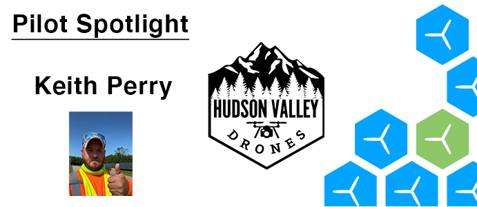
Keith Perry is a Professional Drone Pilot located in Upstate NY. He’s been in business in the industry full time since 2018 and specializes in asset inspections, thermal imaging, photogrammetry and first responder training. When he’s not flying drones, he enjoys spending time with his wife Dena, and his dog Henry, and is a volunteer firefighter with the Gardiner Fire Department.
You’re invited to our next Educational Webinar:
Tips on submitting an ATC Authorization through FAADroneZone
May 26, 2022 @ 1:00 pm PST
RSVP
| AUVSI Xponential April 25 – 28, 2022 Orlando, FL |

|
| FAA Drone Symposium April 28, 2022 Orlando, FL |
|
| Utah Aeronautic Conference May 9-11, 2022 Provo, UT |
|
| Energy Drone and Robotic Summit June 20-22, 2022 Houston, TX |
|